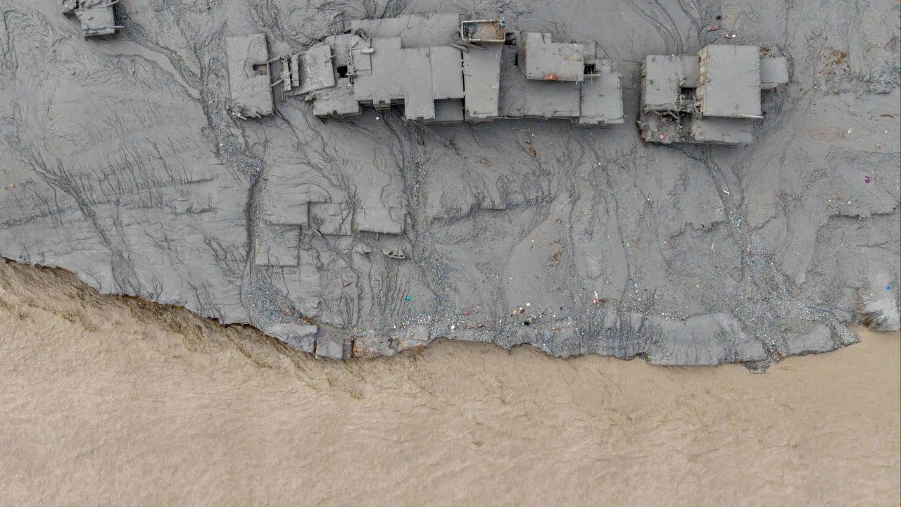
When an ice-rock avalanche and subsequent flash flood obliterated the Gyirong Port border crossing along the Himalayas, it wasn't just a localized tragedy. It exposed a harsh reality about engineering grand ambitions across the world's most volatile mountain range. If you've been following infrastructure trends in South Asia, you know that building railways through high-altitude terrain is already an uphill battle. Now, the catastrophic loss of life and severe damage to valleys near the proposed China-Nepal railway route force a brutal question: are we ignoring glaring safety risks for political prestige?
Let's look at what actually happened. The August flash floods triggered a high-altitude tsunami of mud, water, and ice that swept through critical border areas and trapped workers in hydropower tunnels. Planners have long dreamed of connecting Lhasa to Kathmandu through a multi-billion dollar rail link passing right through these vulnerable valleys. But when nature wipes out regional infrastructure in a matter of hours, grand blueprints need an immediate reality check. You cannot simply pave over active glacial fault lines and hope for the best.
The Fragile Reality of Himalayan Megaprojects
Building railways through the Himalayas isn't like laying tracks across flat agricultural plains. You're dealing with extreme altitudes, active tectonic fault lines, and rapidly melting glaciers that create massive glacial lake outburst flood hazards.
When you study the geography of Gyirong and surrounding border zones, the risks become obvious:
- Unstable mountain slopes prone to sudden landslides and rockfalls.
- Glacial lakes expanding rapidly due to rising global temperatures, creating natural dams that can burst without warning.
- Heavy seasonal monsoons that turn narrow river basins into violent torrents.
Engineers on the ground face a constant battle against physics. When a flash flood alters entire river basins and buries tunnel entrances under meters of debris, standard construction timelines fly out the window. If a high-speed rail line had already been operational through this exact corridor during the recent disaster, the human cost could have been exponentially higher.
Moving Past Outdated Safety Assumptions
For years, bilateral infrastructure discussions have focused heavily on engineering feasibility and economic returns while treating environmental hazards as secondary checklist items. That approach is broken. Real safety requires real-time data sharing, joint early-warning systems, and a willingness to scrap routes that cross high-risk zones.
While agencies have started deploying advanced AI-powered meteorological solutions and satellite tracking to assist with cross-border disaster response, technology alone won't fix poor routing. Planners need to embrace strict hazard assessments before spending billions of dollars on paths that nature can erase overnight.
If you're evaluating the future of cross-border transit in the Himalayas, keep these practical realities in mind. First, route selection must prioritize geological stability over the shortest geographical distance. Second, real-time hydrological data must be shared transparently across borders before construction even begins. Finally, governments need to accept that some terrain is simply too hostile for heavy rail infrastructure.
Stop treating every climate-driven catastrophe as an unpreventable fluke. It's time to demand better planning and safer execution.
Nepal floods: Could Flash Floods Derail China-Nepal's Ambitious Railway Project To Kathmandu?
This video explores how recent flash floods and environmental hazards near the border threaten the viability of the proposed railway link.