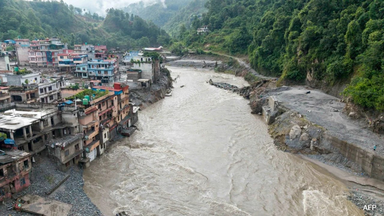
Ice is falling off the roof of the world, and valleys below are paying the price. When a massive ice-rock avalanche triggers a 5.2-magnitude seismic signal at 5,200 meters in the Himalayas, you know the physical rules governing mountain safety have fundamentally broken.
Nepal sits on a tectonic collision course where the Indian plate pushes into Eurasia at about twenty millimeters every year. Combine that tectonic violence with high-altitude atmospheric warming, and you get an unstable playground for flash floods and glacial collapses.
Most people think mountain floods come from heavy monsoon rains alone. That is a dangerous misconception. The real threat is happening thousands of meters above human settlements, where melting ice and shifting terrain are rewriting hydrology in real time.
The Physics Behind High Altitude Collapses
Temperature changes at extreme elevations don't mirror what happens down in the cities. High-altitude summits warm significantly faster due to thermal radiation feedback and shrinking snow reflectivity.
The freezing line is creeping upward. Precipitation that used to fall as heavy, stable snow now arrives as warm liquid rain at elevations that should stay frozen year-round. This liquid water sinks into crevasses, melts internal ice cores, and destabilizes steep rock faces.
As glaciers retreat, they leave behind massive, unanchored mounds of rock, gravel, and silt called moraines. Without the structural mass of ice pressing against valley walls, these loose slopes slide easily.
Dr Manish Mehta from the Wadia Institute of Himalayan Geology notes that glaciers leave behind huge quantities of loose debris. Rising temperatures shift snowfall into rainfall, causing this loose moraine to shift downslope and form unstable lakes at lower elevations.
When these natural dams break under hydrostatic pressure, the resulting surge transforms ordinary river channels into violent debris torrents.
Why Altitudes Above 2,800 Meters Are Ground Zero
Geography dictates vulnerability here. Areas situated above 2,800 meters face the highest risk because they sit directly in the footprint of retreating ancient glaciers.
When a glacial lake outburst flood or a high-altitude avalanche happens, the rushing water doesn't stay clean. It carves through loose moraine deposits, loading the flow with millions of tons of boulders, mud, and debris. This converts a standard river surge into a high-density mudflow that scours everything in its path.
Downstream communities like Timure and Syabrubesi learned this the hard way when the Lhende Khola catchment breached, sending destructive waves through the Bhote Koshi and Trishuli river systems. Hydropower projects, bridges, and mountain settlements get wiped out in minutes because infrastructure built decades ago was never engineered for debris-choked mega-floods.
What Actually Works Now
Traditional disaster management focuses on building higher concrete river walls. That strategy fails when the riverbed itself rises by ten meters overnight due to accumulated silt and rocks.
Protecting mountain communities requires shifting from reactive defense to active regional monitoring.
- Upstream sensor deployment: Installing real-time acoustic and pressure sensors on high-altitude moraine lakes to detect water movement before a breach occurs.
- Cross-border data sharing: Integrating seismic and hydrological data between high-altitude nations because water and ice do not respect political boundaries.
- Strategic relocation: Moving vulnerable infrastructure and permanent settlements away from narrow gorge bottoms down to safer, higher terraces above the historical debris line.
You cannot stop glaciers from melting. But you can stop pretending that nineteenth-century engineering will protect twenty-first-century mountain populations.
Assess your local geography if you live or work near high-altitude river basins. Identify safe secondary evacuation routes that avoid narrow river channels entirely, and demand that local disaster authorities prioritize upstream sensor networks over downstream concrete walls.