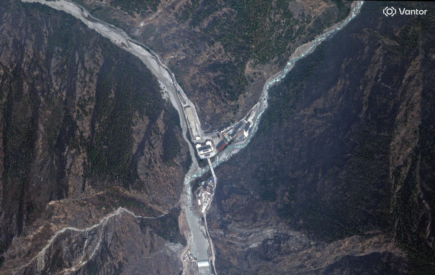
High-altitude ice doesn't negotiate. When a massive slope failure hit the Langtang Lirung glacier on August 26, 2026, it released an energy equivalent to a 5.2 magnitude earthquake in an instant. Orbiting sentinels like the European Space Agency's Sentinel-2 and Planet Labs captured the aftermath. Before-and-after satellite frames show entire river corridors radically rewritten, valleys choked with debris, and the sheer scale of the bedrock landslide that triggered a debris avalanche rushing down toward the Lende Kholā and Trishuli River valleys.
Orbital imagery gets shared everywhere after a crisis, but it hides the messy reality on the ground. Let's look past the pixels to understand what actually happened along the Nepal-China border.
The Blind Spot of Orbital Views
Satellites are great for capturing wide-angle destruction. They show you where roads vanished and water levels swelled. But they don't capture the noise, the missing people, or the chaotic struggle of emergency responders trying to navigate blocked mountain terrain.
Following the August disaster, official tallies reported over 1,000 deaths in Nepal alone, with thousands more missing. Ground teams faced ruined infrastructure, severed communication lines, and unstable slopes that made recovery work perilous. When you look at a clean before-and-after comparison map from the Copernicus Emergency Management Service, it's easy to forget that hundreds of buildings in places like Syapru Besi were completely buried under feet of mud and rock.
Why High-Mountain Hazards Are Accelerating
Glaciers are shrinking and destabilizing globally. As global heating accelerates mountain ice melt, bedrock loses its structural support. Steep slopes that stood firm for centuries suddenly give way.
The August 2026 event wasn't just a routine seasonal flood. It was a massive bedrock landslide originating from an elevation of over 5,000 meters. The sheer volume of material—estimated in the tens of millions of cubic meters—turned into a liquefied battering ram. It surged nearly 100 kilometers downstream, overwhelming border crossings and wiping out hydropower installations.
You can't fix these risks with simple river walls. Communities strung along Himalayan valleys face systemic hazards that require better early-warning tech, radar monitoring of unstable ice caps, and realistic evacuation plans.
What Happens Next for Vulnerable Mountain Settlements
Mapping the damage via Vantor and Landsat-9 imagery is step one. Step two is figuring out how people live in regions where the geography itself is shifting beneath their feet.
Local authorities and international agencies now face tough choices. Rebuilding bridges and roads in the exact same spots invites the next disaster. Planners have to look at long-term relocation strategies for high-risk zones along the Trishuli River corridor.
Satellites give us a vital bird's-eye view of destruction, but preventing future catastrophes demands listening to what the ground is telling us before the next slope fails.
Satellite Images Show How Deadly Floods Reshaped Parts Of Nepal
This video provides visual confirmation of the dramatic landscape transformations captured by orbital sensors following the Nepal disaster.